These are smart people...
This is a stupid person...
When you are doing a lot of traveling on your own and you keep running into groups of people getting onto buses, it is easy to develop a disdain for them. I found myself starting to feel a little superior. I am, after all, doing all of myself - finding places stay, food to eat, transportation just across town, not to mention city to city, etc. However, on my second day on Rebun Island, about halfway through my "walk," I started looking at those tour buses and the people in them, in a whole different light. I started feeling pretty silly, stupid and humble, while wondering if maybe I could hitch a ride on one.
But first, breakfast...
When I came down for breakfast, I was informed that there was rain forecast, but mostly it would happen after 6:00 that evening. Maybe I'd get some sprinkles, but mostly wind. Mostly wind…I'll say!
When I am at home, I don't usually eat breakfast (other than in the general sense of your first meal of the day being the fast breaker). I stopped eating breakfast in high school. I couldn't deal with food churning around in my stomach during the long and stressful bus ride south to Locke High School in the heart of Watts. Getting through a day at Locke required my undivided attention. Consequently, these ryokan breakfasts struck me as a bit over the top. As things turned out, I was glad I had it. Also, there is no saying "no," to these people. The breakfast is there, you are going to eat it.
 |
| What's in the silver cup? Octopus. Raw. |
 |
| Then she brought out rice. |
 |
| Then she brought this out. |
The night before, I had informed my ryokan family of my planned walk for the day. Though they spoke very little English and I even less Japanese, they managed to convey to me that I had surely lost my mind and had better take a different route. Not being a total dope, I decided to follow their advice. Because of the rain forecast I packed my poncho along with my trusty GPS, a map and other equipment and set-off. As I was leaving, my host said, if it gets dark, I should call him. I'm standing there wondering what the hell he is talking about, "gets dark." I am taking what is advertised as the 4-hour course, add a half-hour for me to get to the starting point, its 10 AM, how the hell is it going to get dark before I get back. I thank him and move out.
 |
| This is a map of the "courses." It is a lie. They are all lies. |
 |
| For your orientation: Kafuka is the port where the ferry lands. Most of the hotels are there. My ryokan was up at the top, just across the road from Lake Kushu, one street removed from the sea. |
From a web site:
Kafuka /1/

It is a main town of this island, and
is the port of arrival from Wakkanai and Rishiri island.
It is located in the southern part of the island.
There is a few hotels in this town.
Momoiwa /2/

It is a rocky mountain located 1.5
km
west of Kafuka town.
The name means "peach rock", because they say the shape is similar to a
peach.
Nekoiwa /3/

It means "cat rock", and is a rock
like a cat.
Jizouiwa /4/

It means "a rock like a kind of
Buddha statue". A tall rock stands near the west coast.
Lake Kushu /5/

It is the only lake in Rebun island,
and is located in the north part of the island.
In spring many flowers of white arum bloom on the lakeside.
Cape Sukai /6/

It is a cape located in the
northwest part of the island.
The water of the inlet is very clear, then this is one of the popular
spots in Rebun island.
Cape Sukoton /7/

It
is a cape located in the northmost of the island.
we can see "Todo island" off the coast. If it is fine, we may see
Sakhalin island from here.
 |
| This is Lake Kushu, from across the road. There is a camp ground there. |
 |
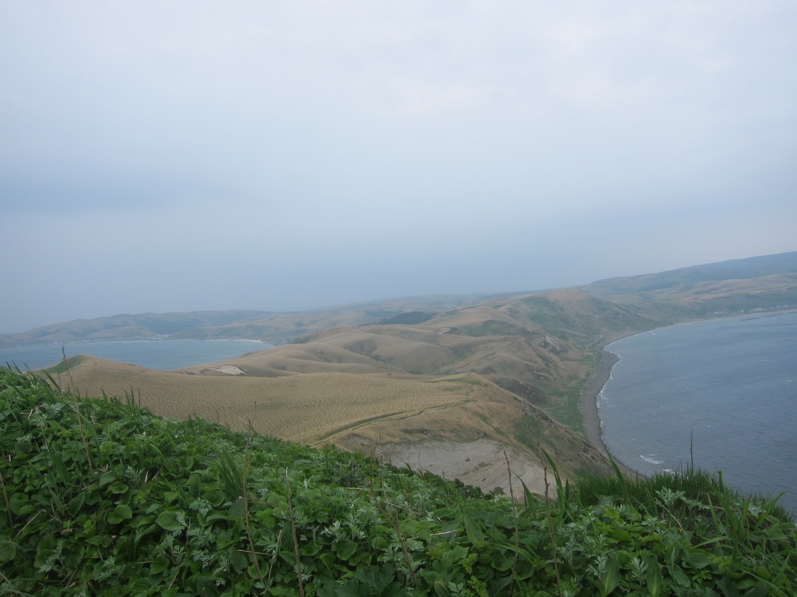
| This is the bay across from Lake Kushu. In the distance is Cape Sukoton. |
 |
| A fisherman allowed me to take shots of his catch. |
 |
| This is Hamanaka, one of the end points of the 4-hour course. You can see from the two maps that it took a bit of walking just to get here. |
 |
| Rolling hills, covered in bamboo. |
 |
| I hadn't realized yet that these were the smart people. Weather doesn't look bad, does it? |
 |
| This is looking at the bay between Cape Sukai and Cape Gorota. |
 |
| Looking over Nishi-uedomari . |
I missed this turn for the trailhead. I saw the sign, but it was misleading. I think it would have even mislead a Japanese speaker. I went into shop for smart people to ask. There was an English-speaker, "Up the stairs at the Tori, then a narrow path." There were two buses of smart people that were also stopped at Teppu.
 |
| When she said "narrow path, "she wasn't kidding. |
 |
| Rebun is all about the alpine flowers. It had been a long winter, so I was a little early for the full blooming, but there were a few. |
 |
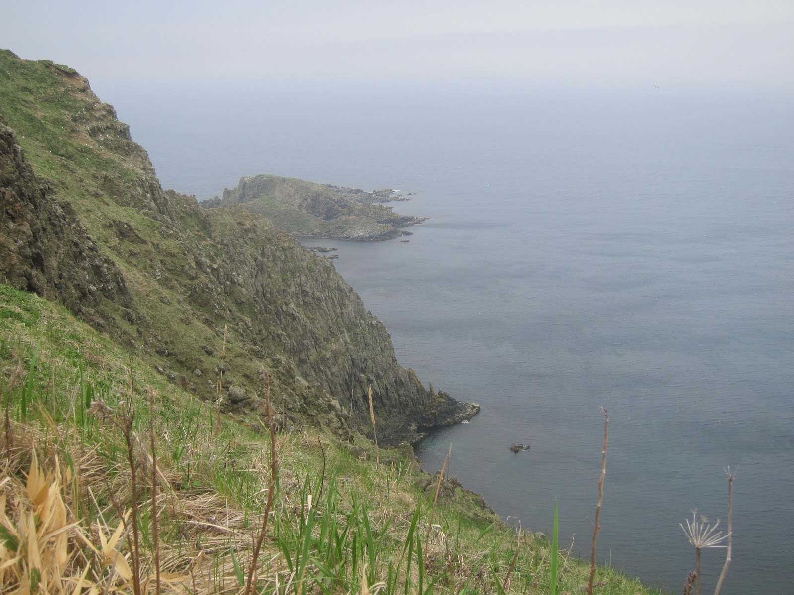
| Views of Cape Sukai. |
 |
| Looking towards Cape Gorota from Cape Sukai. |
I am at a pretty high elevation at this point. The wind has become very strong. It has knocked me off my feet twice already. Off my feet, twice. I've had to put on my jacket and deploy the hood. I have hardly ever deployed the hood. There have been drops, many drops of rain. My attitude towards buses and the people in them is changing.
 |
| Teppu. The trail is still narrow. |
 |
| Looking towards Gorota. |
 |
| Tadpoles on the road. |
 |
| Teppu. These villages are really small. |
 |
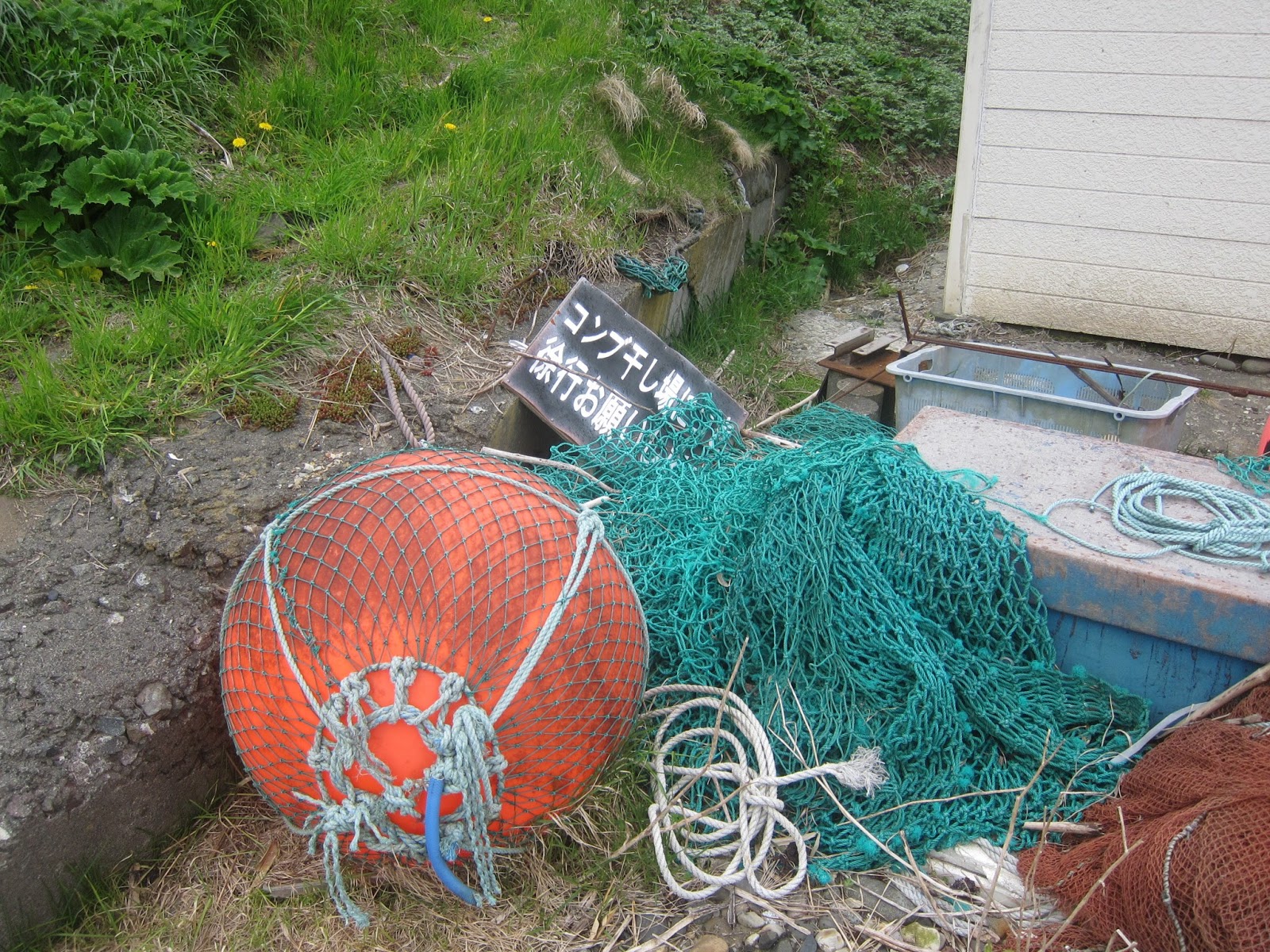
| A lot of dried fish around the island. |
 |
| Looking towards Gorota. |
 |
| Looking back towards Sukai. |
 |
| Sea urchins everywhere. I figure the sea gulls drop them to break them open. |
 |
| This is when I really started to question what I was doing. Remember the wind. Remember the intermittent rain. |
 |
| Working my way towards Gorota. I had been knocked off my feet another time by now. |
 |
| Looking towards Edoya. |
 |
| Cape Sukoton in the distance and Todo Island just beyond it. |
 |
| Oh my, smart people again. |
 |
| Possibly the best shot in the whole blog; looking towards Edoya on the right and Cape Gorota on the left. |
 |
| Slightly different shot. |
 |
| Cape Sukoton and Todo Island. But, I am not there yet. Not even close. |
 |
| Gorota Misaki. |
 |
| Cape Gorota. |
Onwards toward Sukoton...
 |
| Looking back at Cape Gorota. |
 |
| That is more of the trail going across that mountain. |
 |
| A grave yard, sparsely populated. |
 |
| A reality check. |
 |
| I had a choice here of going down through Awabi koton or taking a higher trail. I made the mistake of going down. |
 |
| As far as I can make out, "Awabi koton" means "abalone ending." |
 |
| It was mistake because I didn't find the way back up. I kept walking until there was nowhere else to walk. It was very uncomfortable, because for all intents and purposes, I was walking through people's backyards. Fortunately, there seemed to be no people around. |
 |
| This is why I at first passed where the trail ascended, the sign had fallen down. I was only able to see it when I was backtracking. |
 |
| Looking down on Awabi koton. |
 |
| Looking down on Awabi koton. |
 |
| See the ropes on the roof, extending down the sides? They are weighted; they are there to keep the roof on during the crazy wind storms. |
 |
| More smart people. |
 |
| Todo Island. It is uninhabited. |
 |
| Ha, ha, ha! |
 |
| The very little village on the cape. |
 |
| The bus stop. |
 |
| Just a little ways to go. |
 |
| Here we are, almost twelve miles later. |
 |
| At this point I am about as far as you can go. I am past the barriers. I'd pretty much have to go into the water to get any farther north. |
I've made it. The "Four-hour Course," shows up on my pedometer as over 11.5 miles and it is pretty trustworthy. Their measurement must be "as the crow flies." I am exhausted, it is windy, it is raining off and on and looking like it is going to get worse. About a mile before I got to the shop, I said to myself, "If that shop has chocolate, I'm going to buy some and eat it." The guys in the shop are real friendly. There is one who used to live in Los Angeles and speaks extremely fine English. I didn't see any chocolate, so I bought an ice cream cone. The ice cream was made with seaweed for crying out loud. Hokkaido, particularly Wakkanai and environs is famous for it seaweed.
 |
| Bus people would look at this sign then laugh and laugh. I have since found out that is informing you that is most north toilet in all of Japan. |
 |
| Just thought I'd have an ice cream. I felt like I deserved it. |
I asked the guys if the bus stops here or at the shelter I saw down the road? I had long ago determined that I was taking the bus back as close as it got to the ryokan. They told me I could get it there. Fantastic. When? 7:16 PM! It was 5:00 PM. Hell, I could walk it in that time. "Yeah, but its raining," I was reminded. It was raining. It was getting dark. I knew from my walk the previous day that if I were fresh I could probably do it in two hours. At the ryokan they were expecting me for dinner at 6:30. Proving once again that I fall into the category of a stupid person, I said I better get started and out I walked. I got about 100 yards, it started raining harder, I came to my senses. I went back. (So, at least not profoundly stupid.) The English-speaker was nowhere to be found, but I managed to get one of the other guys to use my cell to call the rokan and tell I'd be late because I was going to wait for the bus. They said hold tight and came and picked me up. Of course, I got them a gift.
And I discovered that they did have chocolate at the shop, albeit white chocolate - MADE WITH SEAWEED!
After a shower, I came down to dinner...
 |
| Sea cumber - raw. |
 |
| Hake. |
 |
| The family and me. |
The wind was crazy that night, worse even than in Wakkanai. It shook the building several times. The building did not strike me as poorly constructed. The rain wasn't so bad.


No comments:
Post a Comment